
How do I export a Floating Point Geotiff using QPS Qinsy?
Prepared with Qinsy v9.5.1
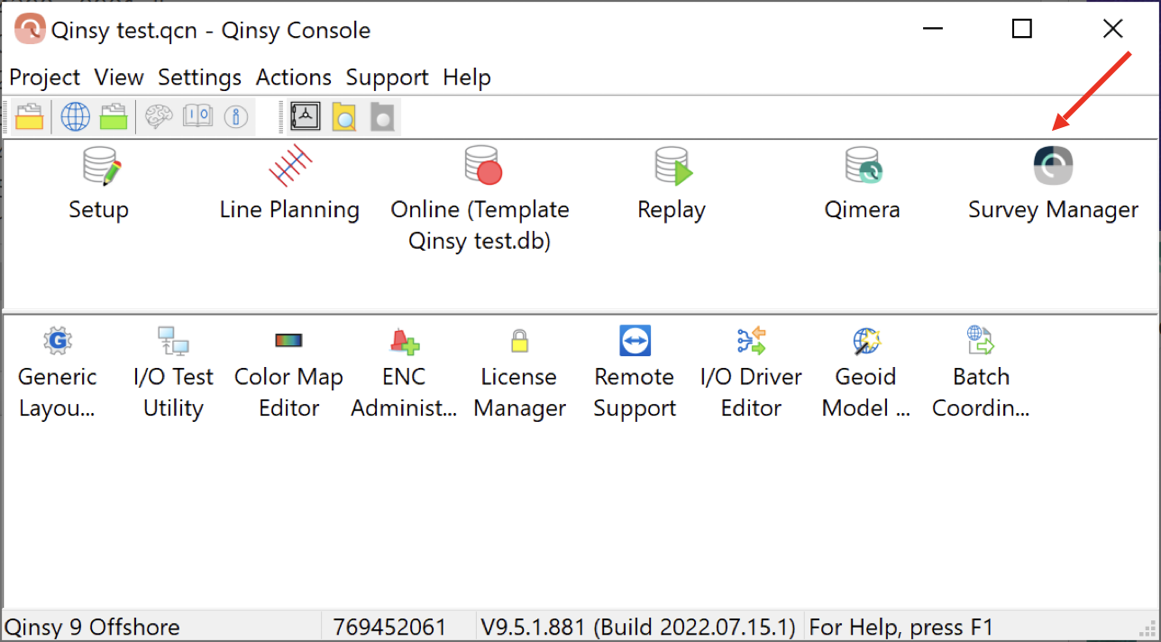
After recording in Qinsy, launch the Survey Manager tool from the Qinsy Console.
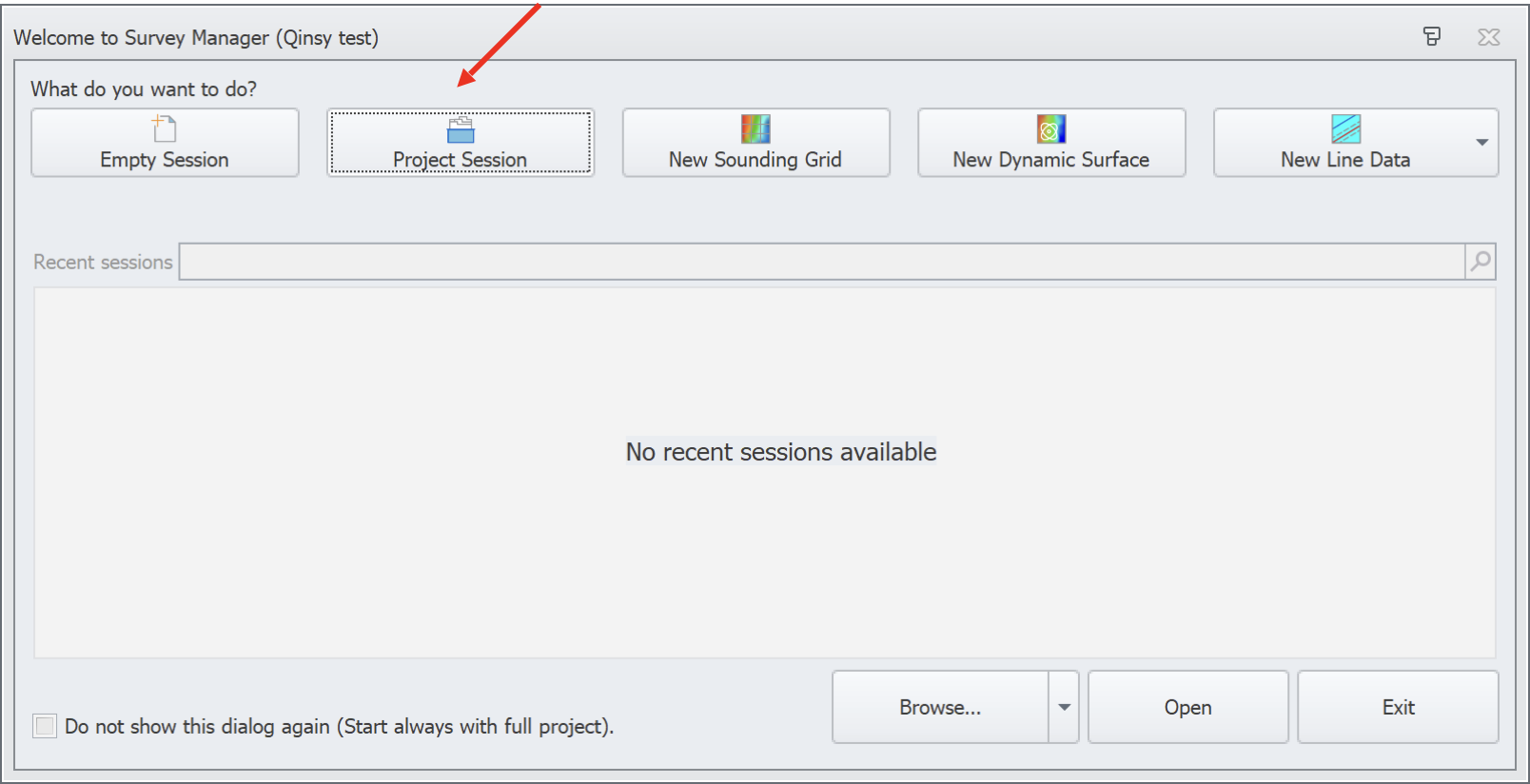
You’ll be prompted on which kind of session you’d like. Choose “Project Session”.
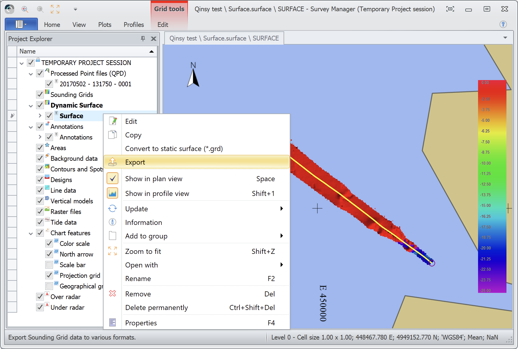
From the Project Explorer dock, right click on the grid you’d like to export, choose the Export option.
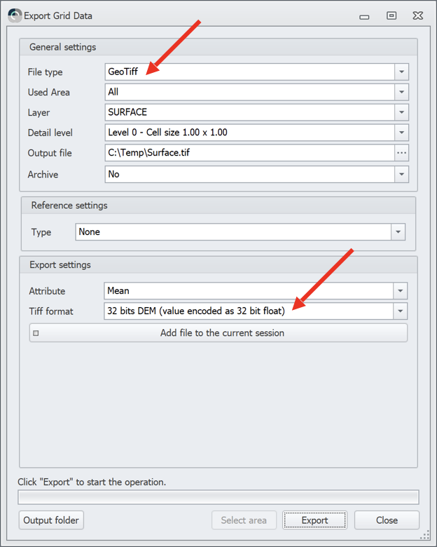
Select “GeoTiff” as the File type. Select “32 bits DEM” as the Tiff format. Click Export, then Close. By default, the GeoTIFF is saved in the Project Folder’s “Export” directory.
Qinsy will export a GeoTiff file, along with a few companion files with file extensions such as .wkt, .tfw and .kml. You only need the .tif file for upload to Absolute Ocean.