
How do I export a Floating Point Geotiff using QPS Qimera?
- Prepared with Qimera v2.4.9
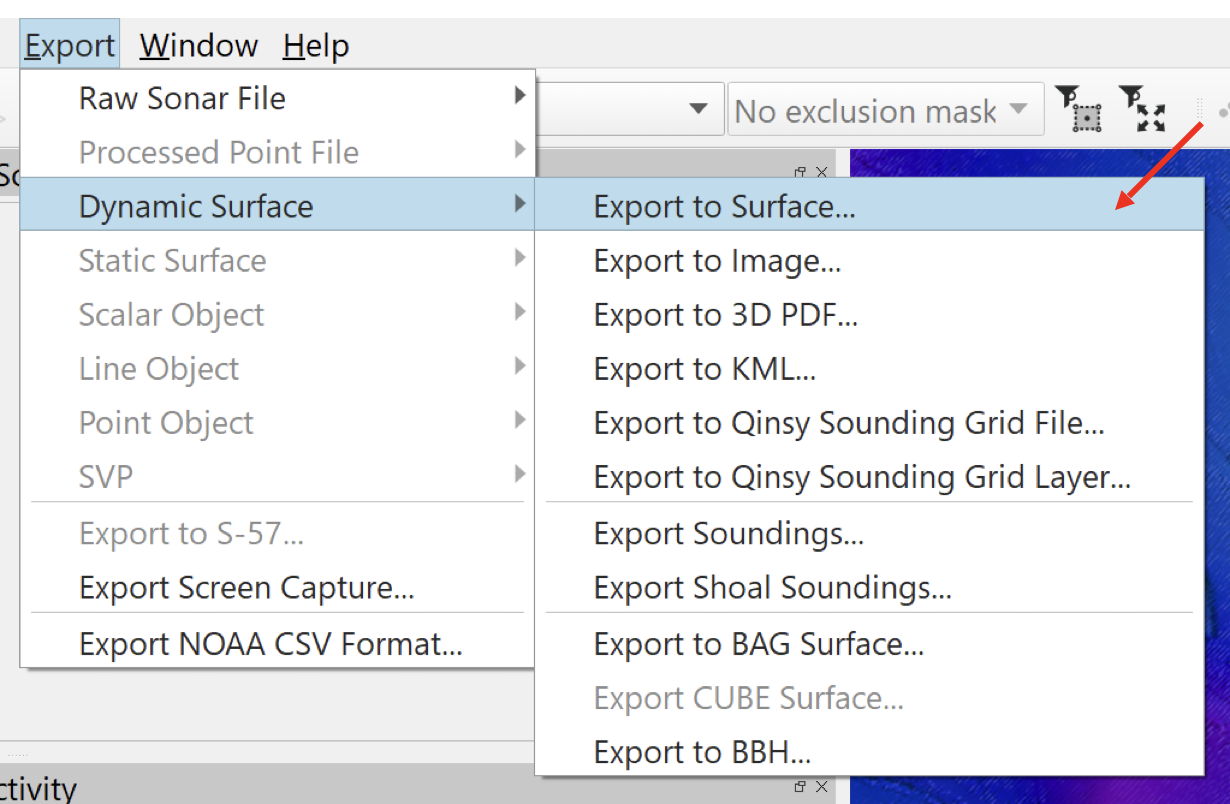
Select the Dynamic Surface you want to export in Qimera’s Project Layers dock. From the Export menu, choose “Dynamic Surface” -> “Export to Surface…”
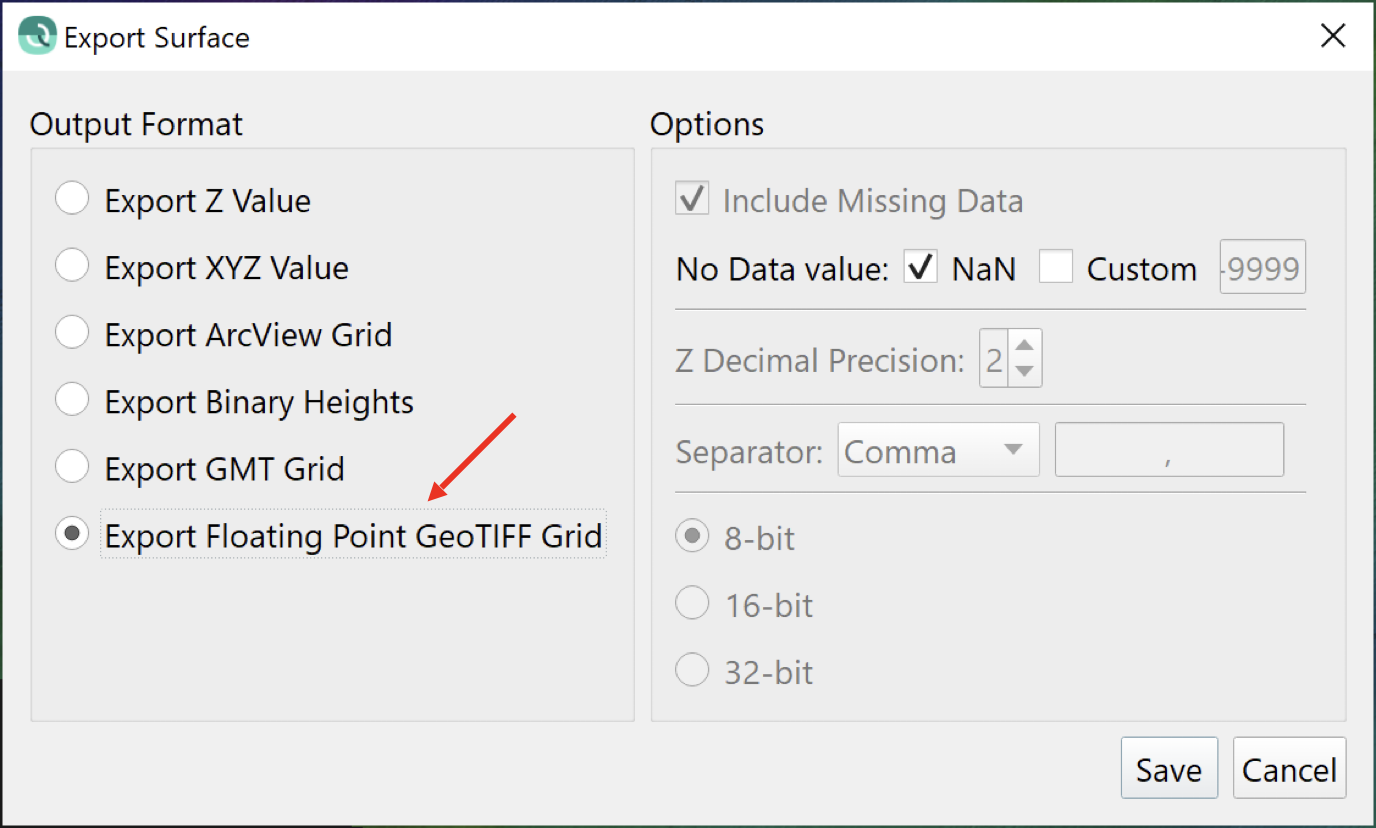
In the Export Surface dialog, choose the GeoTIFF option and click Save. By default, the GeoTIFF is saved in the Project Folder’s “Export” directory.