
Prepared with Fledermaus v8.5.0
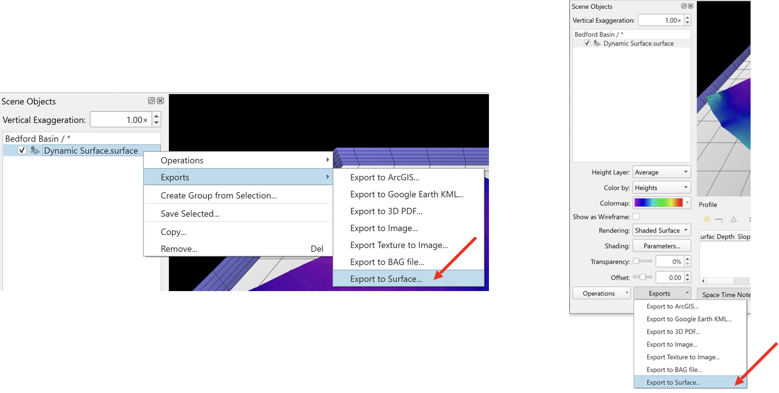
Once your Dynamic Surfaces are in the current Fledermaus Scene, right-click on the surface of interest in the “Scene Objects” dock, choose “Exports” and then “Export to Surface…”. Alternately, you can click the “Exports” button at the bottom of the “Scene Objects” dock, then choose “Export to Surface…”.
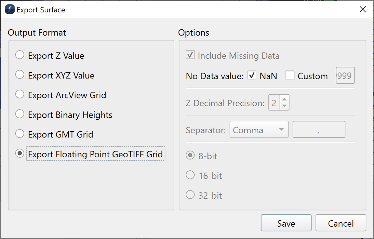
In the Export Surface dialog, choose the GeoTIFF option and click Save. You will be prompted to choose a file path and file name.
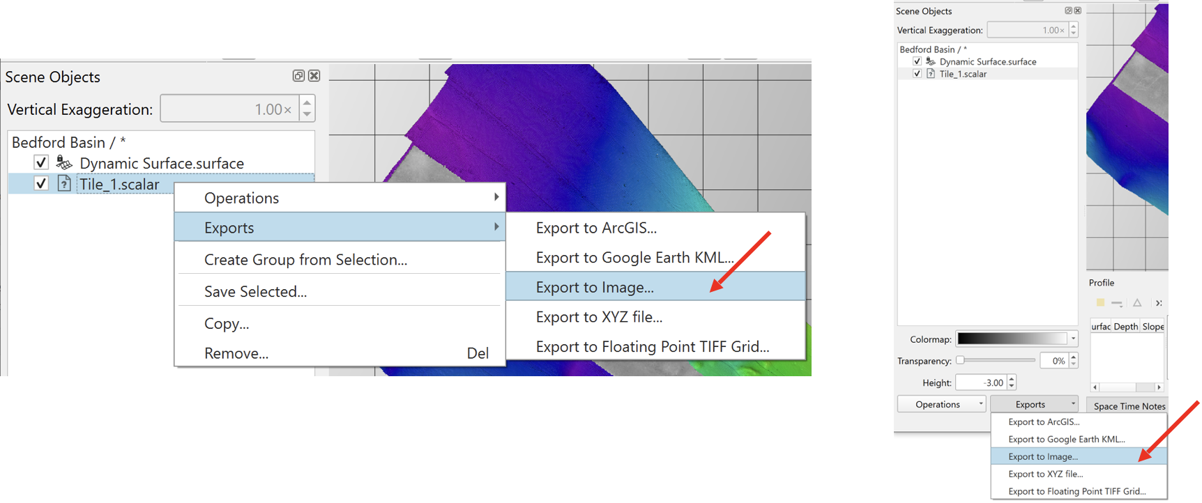
You can also export backscatter mosaics from Fledermaus in the same way that you export bathymetry. Start by selecting your scalar object in the “Scene Objects” dock, choose “Exports” and then “Export to Image…”. Alternately, you can click the “Exports” button at the bottom of the “Scene Objects” dock, then choose “Export to Image…”.
Do NOT select “Export to Floating Point TIFF Grid…” since this will set the z-value in the exported product as a backscatter value, which Absolute Ocean would then want to treat as bathymetry. Backscatter data should be a grayscale Geo TIFF for use in Absolute Ocean.
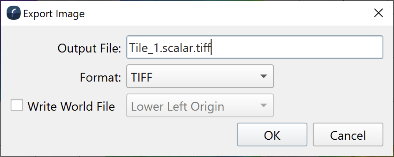
You will be prompted for a file name, enter the name you want and click Ok. Typically, this file is automatically saved in the “Graphics” subdirectory of your QPS Project.