
How do I export a Floating Point Geotiff using SonarWiz?
Prepared with SonarWiz v7.09.04
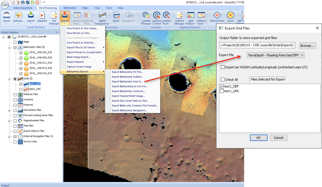
Select your grid from the Project Explorer, then click the Export and choose “Bathymetry Exports” then “Export Bathymetry Grid As…”. In the dialog that launches, choose “Terradepth – Floating Point GeoTIFF” from the options list of file types.