
Major Enhancements
Vertical datum support
We are excited to share that AO now supports vertical datum transformations for visualizations, meaning you no longer have to import your data in WGS 84 vertical datum in order for the data to display accurately compared to the rest of the AO terrain.
When you visualize a bathymetric file, AO will attempt to read the vertical datum from the file header and will default to this is available. Note that this is rarely available. If AO cannot read it from the file, project-level defaults from the Project Details tab are selected (see Screen 2 below). If vertical datum is not available in the file and also not set at a project level, you will need to enter this before visualizing a bathymetric file. Note that the Visualize File screen will show the source of the CRS selections (see Screen 1 below).
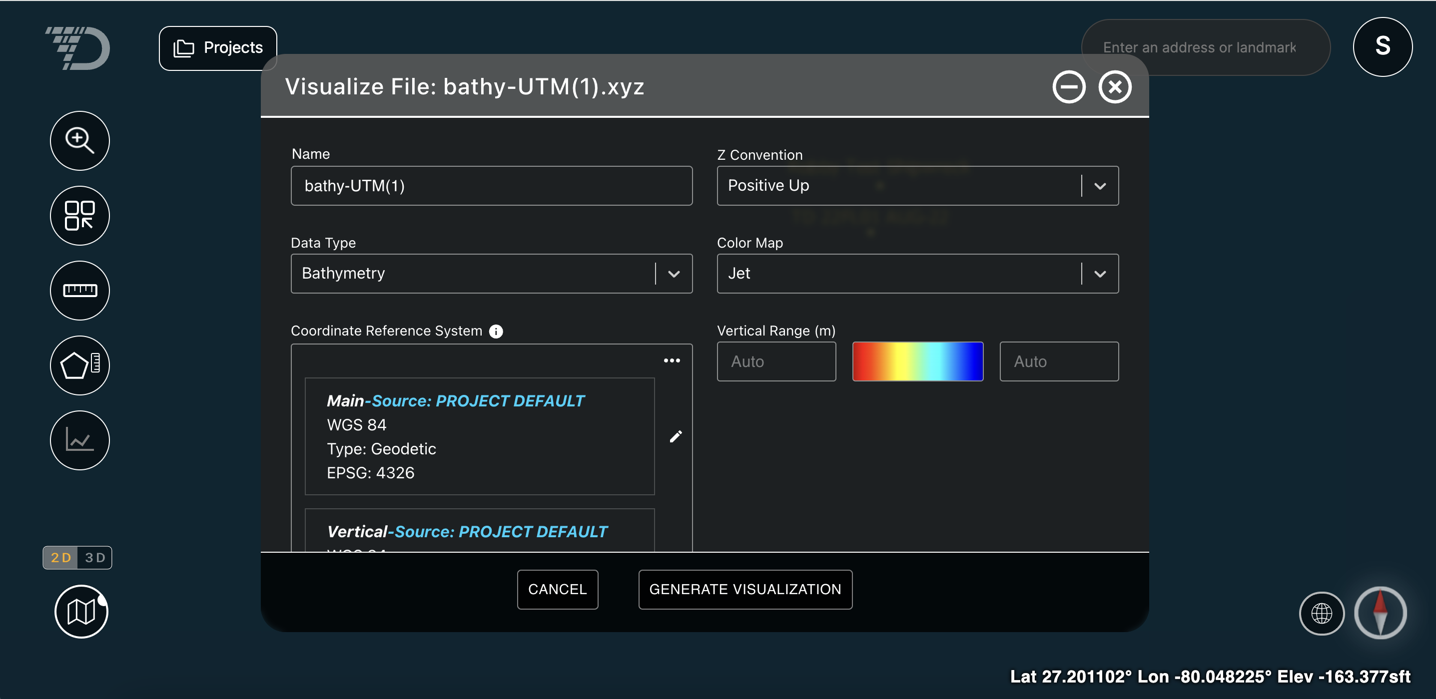
Screen 1: Visualize File window
Please ask your surveyor to provide both vertical and horizontal datum for the data collected and set this as a default at a project level (see Screen 2 below).
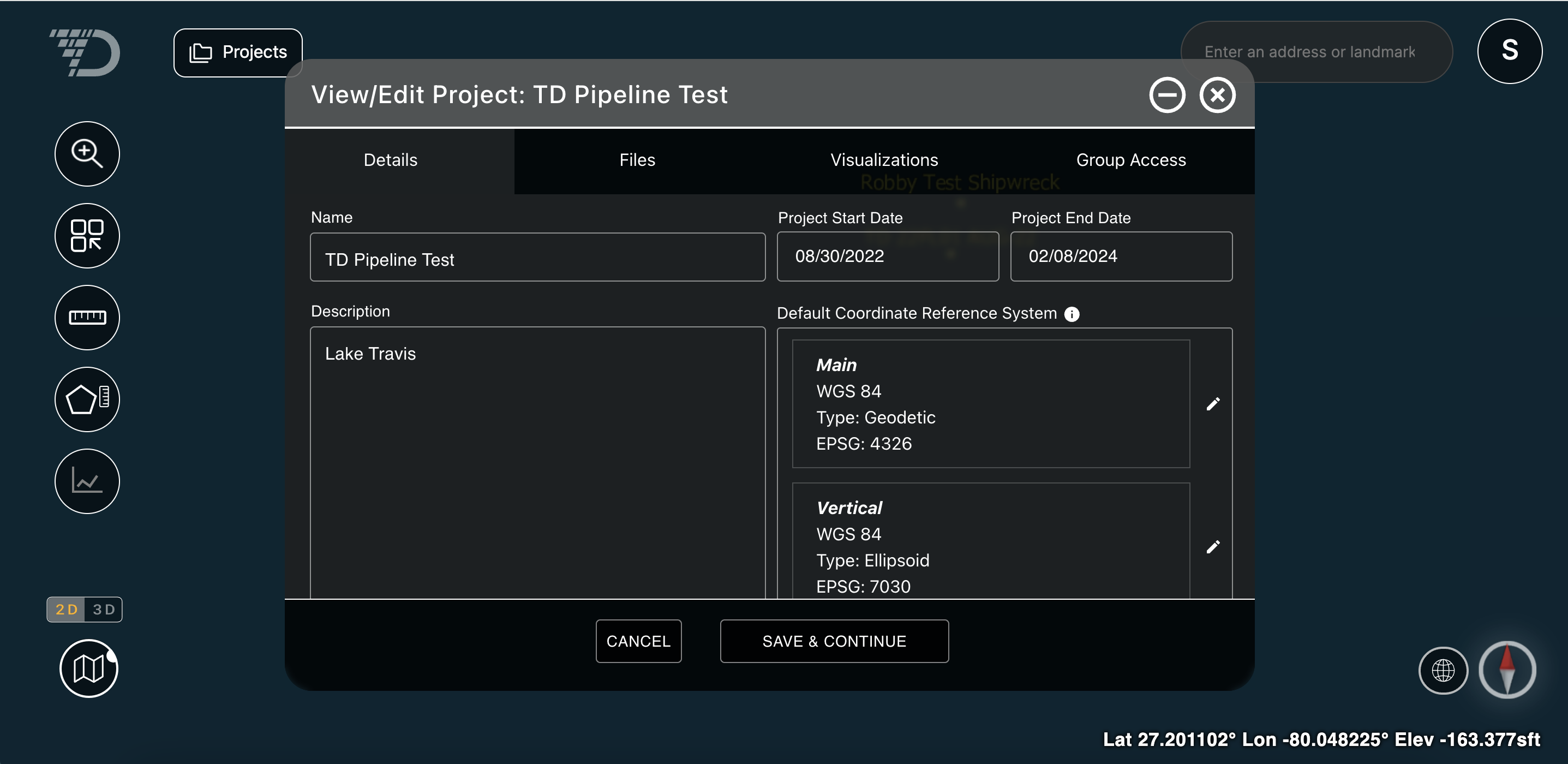
Screen 12 Project Detail window
Note that bathymetric files (both grids and point clouds) require both vertical and horizontal datum, images are draped over terrain and vector files are currently displayed at z = 0 and therefore only need horizontal datum.
For more information on vertical and horizontal datum, please see this help center document: Vertical and Horizontal Datum
Large file suport
Architectural changes have made visualization of very large files possible and also faster. We support very large, high-resolution files and have tested pipeline data files of 1.5 TB of raw, uncompressed data, representing 384B pixels, or an area 7.4 times Manhattan.