
How do I export a Floating Point Geotiff in CARIS?
First, select a grid in the Layers window.
For licensed CARIS software (HIPS, BASE Editor) the Export Raster dialog can be found under File > Export > Coverages > Raster...
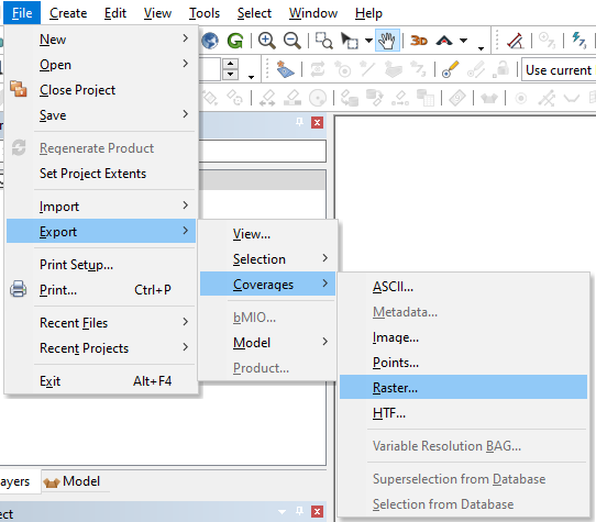
The Export Raster dialog is shown.
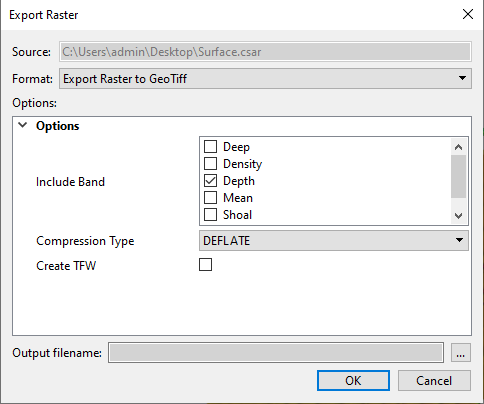
Under "Format" choose "Export Raster to GeoTiff".
Under Options, select a single band to include in the export (e.g. Depth). The default Compression Type (DEFLATE) should be used.
Enter an output filename and click OK.