
Enhancements
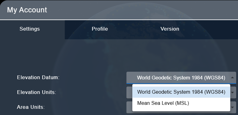
- Choose your own datum! A new setting is available in user profile settings to select whether elevation/depth values are display in World Geodetic System 1984 (WGS84) or Mean Sea Level (MSL). This setting affects the display of Profile Lines, elevation values shown for the user cursor when 3D terrain is enabled, and color map legends.
Issues Resolved
- When uploading a ZIP file with the "Unzip Archives" option enabled, the contents of the ZIP would be placed at the root folder of the Project, regardless of which sub-folder the user is in. ZIP files now properly extract to the current folder.
- Under certain conditions, the Measure tool was not displaying correctly on the screen when in use. This has been resolved.
- Several issues with the Objects have been resolved:
- When selecting an Object from the map, the Object properties are opened instead of the list of Objects
- Objects now remain visible when the Projects window is closed. Clicking the "x selected" button now closes visible Objects.
- Objects now visualize without refreshing the browser.
- Individual Objects will now remain individually visible instead of grouping themselves at certain zoom levels.