
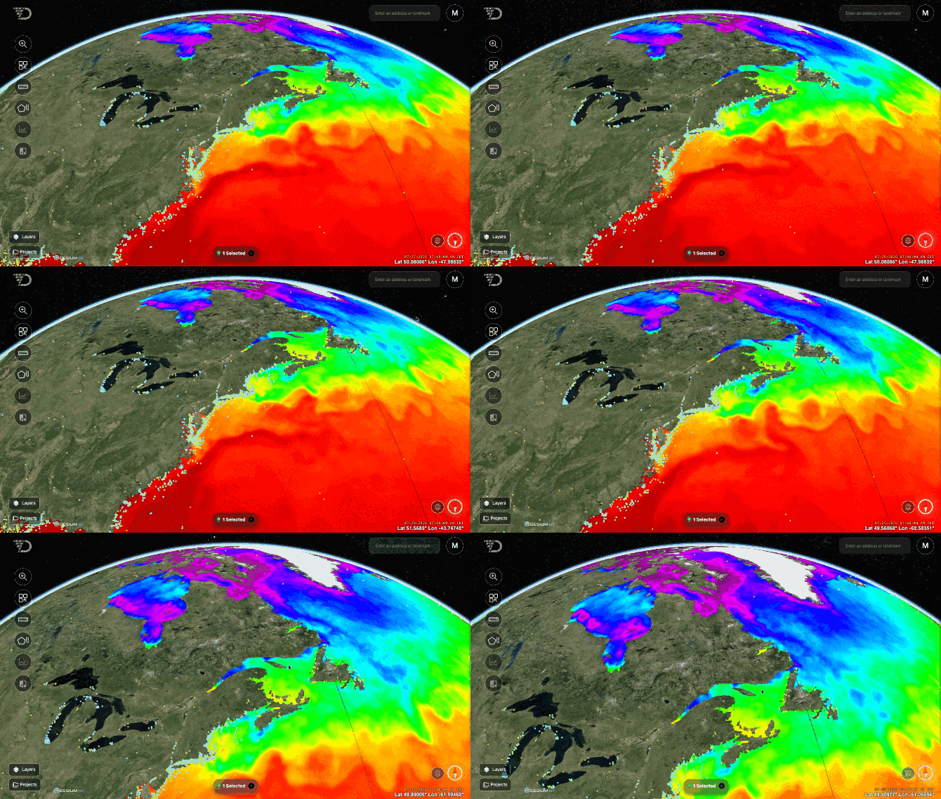
Free public map services publish live ocean and environmental data: ocean temperature, salinity, chlorophyll, currents and forecasts, bathymetry and offshore infrastructure. You can show them in AO as external layers, animated where the service publishes time steps, with nothing imported.
Sources that work in AO
| Source | What it shows | Type | Source URL |
|---|---|---|---|
| NOAA nowCOAST | Surface-current forecasts for US coastal waters, sea surface temperature, weather radar, satellite imagery, storm surge | WMS | https://nowcoast.noaa.gov/geoserver/ows |
| Copernicus Marine | Ocean models and satellite data: temperature, salinity, currents, waves, sea level, sea ice, chlorophyll, with forecasts | WMTS | https://wmts.marine.copernicus.eu/teroWmts/GLOBAL_ANALYSISFORECAST_PHY_001_024 |
| NASA GIBS | Satellite imagery, sea surface temperature, chlorophyll, salinity, sea ice | WMS and WMTS | https://gibs.earthdata.nasa.gov/wms/epsg3857/best/wms.cgi |
| EUMETSAT EUMETView | Weather satellite imagery, sea surface temperature, ocean winds | WMS | https://view.eumetsat.int/geoserver/ows |
| GEBCO | Global bathymetry | WMS | https://wms.gebco.net/mapserv |
| EMODnet Bathymetry | Bathymetry of European seas | WMS | https://ows.emodnet-bathymetry.eu/wms |
| NOAA NCEI | Shaded relief from multibeam surveys | WMS | https://gis.ngdc.noaa.gov/arcgis/services/multibeam_mosaics/multibeam_mosaic_combined/ImageServer/WMSServer |
Copernicus Marine publishes over 180 products. To list one product's layers, end the address with its product ID from the Copernicus Marine catalog, as in the table.
Sources that need help to set up
| Source | What it shows | Why |
|---|---|---|
| NOAA ERDDAP servers, such as CoastWatch and PolarWatch | Satellite sea surface temperature, chlorophyll, salinity and many other datasets | They don't let other websites, such as AO, load their maps in your browser. |
| HYCOM | Global ocean current forecasts | The same. |
| BOEM, Gulf of America | Oil and gas platforms, wells, pipelines, leases and lease blocks | AO can't read the server's list of layers. |
To use one of these, contact support@terradepth.com.
Add one to a project
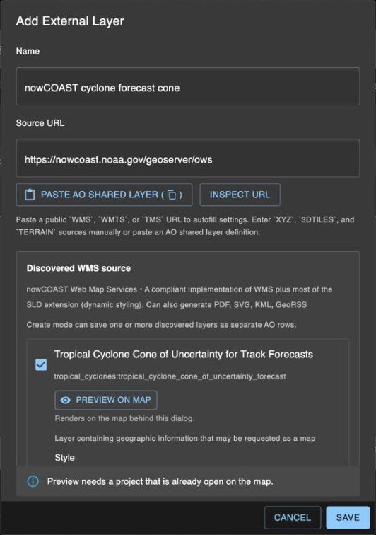
Professionals and Admins add external layers in a project's Layers tab. Choose + (Add external layer), paste a Source URL from the table and choose Inspect URL. AO lists the service's layers. Tick as many as you need: each one saves as its own layer. For the options, see External layers. To show a layer in all your organization's projects, contact support@terradepth.com.
Animation
When a service lists each time step, such as nowCOAST's radar and current forecasts or Copernicus Marine's monthly layers, turn on Loop last X frames to play the latest 2 to 5 frames.
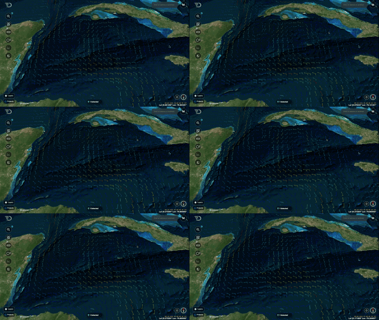
Services that give time only as a range (start/end/period) can't animate in AO. NASA GIBS, EUMETView, and Copernicus Marine's daily and hourly layers work this way. They show a still image: the service's default time.
Things to know
- The provider decides availability and speed. If its server is slow, busy or down, the layer loads slowly or shows nothing. Each provider also sets its own terms of use.
- No color legend. AO doesn't show a legend for these layers. Check the provider's website for what the colors mean.
- For viewing, not analysis. Clicking a layer doesn't show its values, and AO can't chart or analyze them.
- Your network must reach the provider. Your browser loads the maps from the provider, and Inspect URL and animation contact it from your AO server. A self-hosted AO or AO OnBoard server, and your users' computers, need internet access to these hosts. See Network and firewall requirements.
Related: External layers · Layers window · Network and firewall requirements