
What's new in Absolute Ocean (AO) in 2025, newest first. Every release also includes fixes and reliability, performance and security improvements that aren't listed here.
Newer releases: AO Release Notes 2026. All years: AO Release Notes.
December 17, 2025
- AO OnBoard to AO cloud: Remote Sync can now transfer projects, with their files, objects and visualizations, from AO OnBoard to AO in the cloud.
Fixes:
- Transfers and visualizations of very large projects could fail.
- The map could freeze while loading many objects.
- The profile tool was slow and could block the page.
December 3, 2025
Enhancements
- Independent terrains for 3D visualization
- Up to this point, all 3D terrains (i.e. grids) were visualized using a single 3D terrain for the entire planet. (for privacy purposes, each organization was on their own copy of the original terrain). When a new grid was visualized, that grid would be added to the single 3D terrain, overriding any previous heights at that location. This original solution was implemented due to limitations of the underlying technology (CesiumJS).
- As of December 3, 2025, all new grid visualizations will instead become their own 3D terrain, stored separately from the global base terrain. This enhancement unlocks several exciting new capabilities, some of which are included in this release!
- Display of images and point clouds is not affected by this new capability, in fact this means grids are now treated consistently with these other types.
- For customers with existing grid visualizations, they will continue to be available and display correctly (in the old style) in the current version of Absolute Ocean. Behind the scenes, we will migrate your visualizations to the new format in the coming weeks.
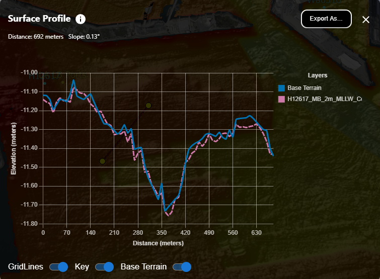
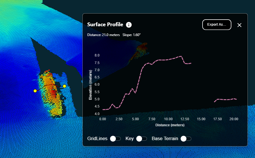
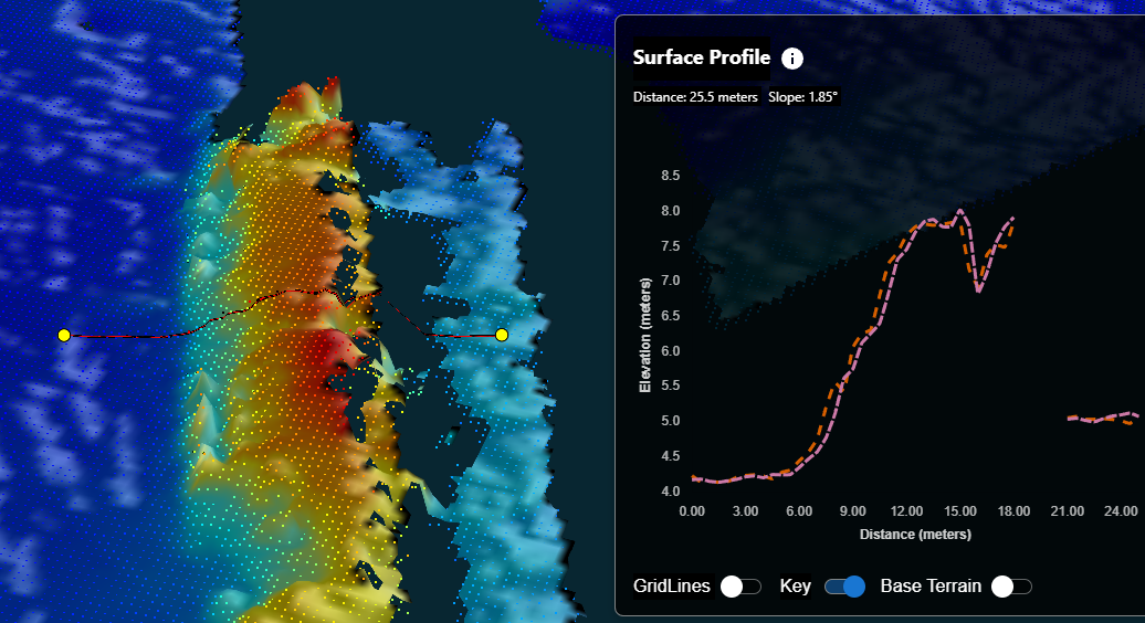
- Profile Tool Enhancements
- When 2 or more grids overlap in the same area, in addition to visualizing independently they can also now be profiled independently!
- Point clouds can also now be profiled:
- Or both!
- When 2 or more grids overlap in the same area, in addition to visualizing independently they can also now be profiled independently!
- Empty folders can now be uploaded to Absolute Ocean, including empty folders nested in other folders.
Issues Resolved
- New accounts would sometimes incorrectly direct a new user to reset a password which has not yet been set. This has been resolved.
- Automated emails for failed visualization jobs have been restored.
- The "Share View" icon sometimes became unresponsive. We have optimized the URL generator to be more efficient and responsive to Share View URL requests.
September 25, 2025
Enhancements
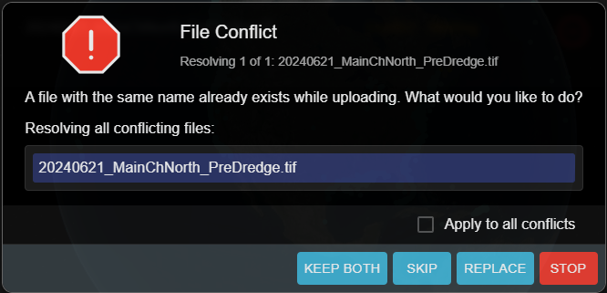
- When uploading files and folders to AO, we now have tools to identify any possible overwrites and prompt the user for an action:
Issues Resolved
- The display status of individual Objects is now honored when creating Share links.
- When uploading a ZIP file containing TIFF files, sometimes the file scanning would not properly identify these TIFF files as files which can be visualized. This has been fixed.
- We have resolved an issue where the vertical datum chosen by the user was not being applied correctly or ignored.
- We have updated our tools to better track and report progress for files which take a long time to visualize.
September 3, 2025
Issues Resolved
- The pre-scanning for visualizable files within an uploaded ZIP file would sometimes fail to correctly identify all files which can be visualized. This has been fixed.
- The alignment of some controls within the Layers window have been adjusted for a better user experience.
August 13, 2025
Issues Resolved
- In the Project Details window, once a field was assigned a value it could not be un-set to an empty value. This is now supported across all fields except Name, Start/End date and Latitude/Longitude, which are mandatory fields.
- Individual files larger than 2GB were causing errors during upload, this has been fixed.
- XYZ files containing more than 3 columns can once again be visualized.
- When a user's session has expired, all windows and controls in the interface now refresh themselves appropriately.
July 23, 2025
Enhancements
- The GeoTIFF raster format is a common exchange format supported by many mapping software suites. However, as an open exchange format there can be different interpretations of the structure and contents of these files across vendors. We previously supported TIFF files containing 1 band of elevation values, 1 band of color, 3 bands of color (red/green/blue) values and/or an optional 4th alpha band (for blending). We have extended our visualization capabilities to also support GeoTIFF files containing 2 bands of color (1 color, 1 alpha).
- ESRI's Shapefile (SHP) file format stores coordinates as Latitude/Longitude on the WGS 84 ellipsoid (CRS EPSG:4326). However, some 3rd-party software packages will allow storing data in coordinate systems other than this standard. We have updated our visualization pipeline to accept non-standard CRS definitions for this format.
Issues Resolved
- Google KML/KMZ files containing sounding values were causing errors when displayed in Absolute Ocean. This has been fixed.
- When a user clicks more than once to add a visualization to the map, this was causing the visualization to be added to the map multiple times behind the scenes. Among other consequences, removing a visualization from the Layers window appeared to not remove it from the map (it is only removing one of the multiple additions). This has been fixed so a visualization can only be added one time to the map.
- Some windows in the interface were not correctly refreshing when the user session is no longer valid (e.g. session has timed out). These have been fixed.
April 30, 2025
Enhancements
- Previously, Absolute Ocean would allow two or more files (or folders) in the same location to have the same name. To better match user expectations, we will now verify file and folder names during upload, and prompt the user to resolve the conflict: skip, replace, or rename the incoming file or folder.
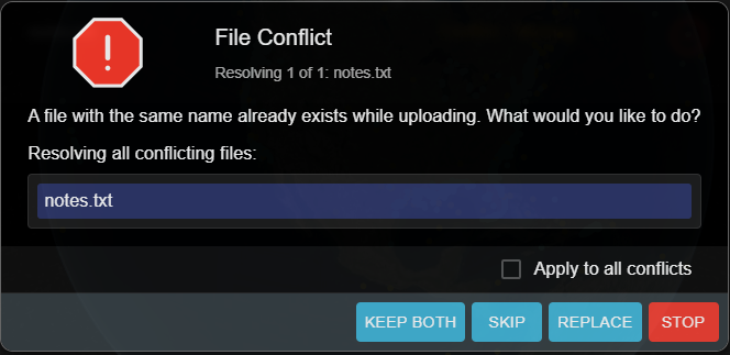 This has been updated in both the Absolute Ocean interface and our command-line batch upload tool. Please contact customer support to receive the new version of the command-line tool.
- Some of our customers have been exploring deploying an on-premise instance of Absolute Ocean, sometimes on networks which do not have access to the public internet. We currently use a third-party service to search and pick EPSG codes, which isn't possible without access to the internet. When this service can't be reached, Absolute Ocean now allows manual entry of the EPSG code as a workaround.
Issues Resolved
- In certain web browsers, all drop-down menus had poor contrast between the text and background color of the control. This has been resolved.
- The Measure Tool now correctly displays distances in the chosen display units.
April 9, 2025
Issues Resolved
- To refine our interface with the addition of the new Layers window, single-clicking a Project on the map will now open the corresponding Project in the Project window. Double-clicking the Project will still add all visualizations in the Project to the Layers window, as it did previously.
- Under certain conditions, visualizations from public Project sources were remaining on the screen even when removed from the Layers window. This has been resolved.
- A logical failure which was preventing the use of vertical EPSG 7030 when visualizing point cloud files has been resolved.
- We have resolved a problem where using any of the Measure tools in the interface resulted in a warning message "Error 403" to appear.
March 18, 2025
Enhancements
Label locations or areas
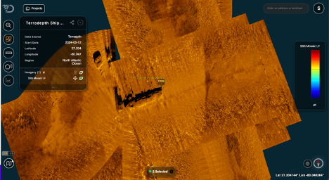
We're pleased to introduce the new labeling feature in Absolute Ocean, designed to enhance collaboration and analysis. This feature allows you to mark specific locations or areas within AO using Objects.
- Admins and Professionals can create and manage Objects, while Admins, Professionals, and Users can view them.
- Each Object is associated with a project, and a new Objects tab has been added to the View/Edit Project pop-up for easy access.
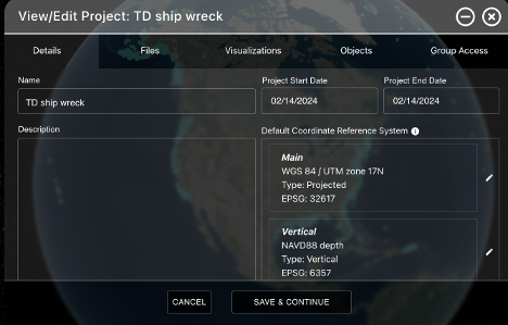
Select the Objects tab to add an Object or see Objects associated with the Project.
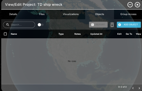
Press the 'Add Object' button to start adding an Object (only visible for Admins and Professionals). Add Name, Label, select Type (Pin or Polygon), Source, Lat/ Long and Notes. If you prefer to point to the location where the pin should be placed, press the pin next to the long input field and select the location, the lat/ long will be filled in for you.
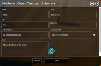
When the eye next to the Pin is green, it's turned on.
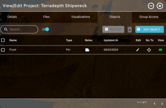
Press the diamond "Go To" button to go to Object.
You can edit and delete the Object from the Objects tab in Projects.
Keep in mind that when you share a view using the ShareView link, any Objects displayed will be shared also and AO user with access to the data and an Admin, Professional or User license will view the Object as part of the ShareView. This makes it an excellent tool for team collaboration and better, more informed decision making.
New layers window
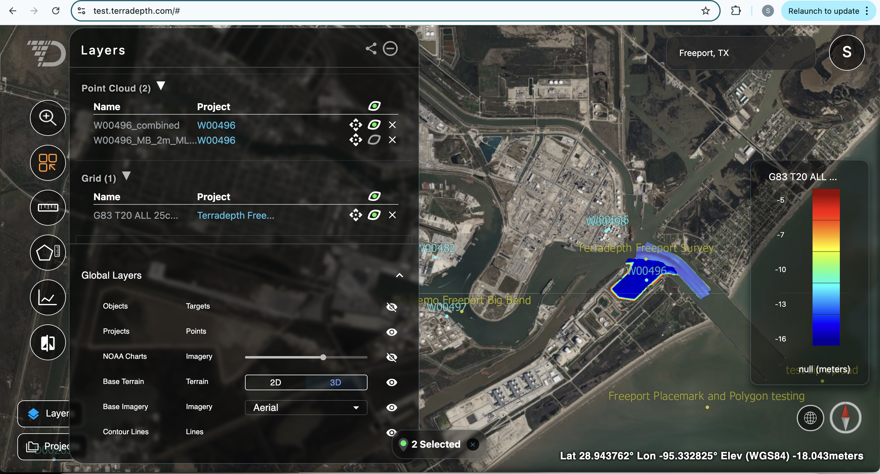
The new layers window in Absolute Ocean allows you to more easily and effectively manage data across Projects. You can now display layers from many projects in the same layers window.
- To visualize/ hide a layer, press the eye next to the layer.
- To remove the layer from the list, press the x next to the layer.
- As with the previous metadata window, you can reorder image layers using the lock button next to the Imagery list in the Layers window.
- In addition, the following actions are available from the Global Layers section within the Layers menu (this section can be accessed using the down arrow in the bottom right of the Layers window):
- You can turn on and off all Project dots using the eye next to Projects.
- Turn on NOAA charts and set transparency using the slider next to it.
- Switch between 2D and 3D mode using the buttons next to Base Terrain.
- Change Base Imagery.
- Turn on Contour Lines; note that this requires you to be in 3D mode first, and contour lines are only displayed when you are zoomed in closer to the terrain.
Issues Resolved
- In some cases, although the elevation values of bathymetry data was accurate, the color map legend did not display using the correct vertical unit. This has been corrected.
February 26, 2025
Enhancements
- New Swipe Tool: What makes Absolute Ocean stand out is its ability to put data in context in the world, which helps drive insight and decisions for our users. In this vein, we are excited to share the latest addition: the Swipe Tool! When enabled, the screen will be split into left and right halves:
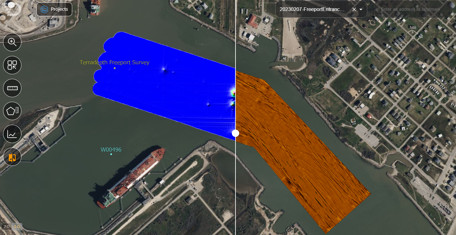 Simply drag the dividing line left or right to compare Visualizations, and use the drop-down added to the upper right of the interface to switch the dataset shown on the right half of the screen.
- New Professional user type: Previously we had a single user role, Admin, which was allowed to create Projects, upload files and visualize data, and could also manage users and groups. To better suit the needs of our users, we have introduced a new user role: Professional. This user has the same Project, file and visualization permissions as Admin users, but without permissions to manage users and groups.
Issues Resolved
- The tooltip displayed in the Profile window when the user hovers over the profile line in this window has been simplified to only show the Depth/Height at the cursor position.
- To keep your account secure, we keep track of how many times a user requests a reset of their password and lock the account if this exceeds a certain threshold. However, we identified a bug which caused this count to increment by values of 2 or more for a single request, resulting in some users inadvertently having their accounts locked. We have identified and fixed the root cause of this issue.
February 5, 2025
Enhancements
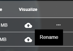
- Files can now be renamed after upload. Click the "..." in the Files view to rename a file.
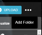
- New folders can be created in the Files view, click the "..." in the upper right next to Upload.
Issues Resolved
- The Color Legend for a given visualization now shows the correct range based on the vertical datum chosen for the interface. Previously, the display range was based only on the original vertical datum of the dataset, and was not transformed if that differed from the display datum.
January 14, 2025
Enhancements
- Offline capabilities: Absolute Ocean has been updated to allow the application to continue to function if an internet connection is lost or unavailable. This capability is targeted primarily at on-premise and/or air-gapped users, but will also benefit users working with intermittent connectivity.
For earlier releases, see AO Release Notes 2024.