
What's new in Absolute Ocean (AO) in 2024, newest first. Every release also includes fixes and reliability, performance and security improvements that aren't listed here.
Newer releases: AO Release Notes 2025. All years: AO Release Notes.
November 20, 2024
Enhancements:
- The Profile tool has been enhanced with a number of improvements:
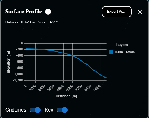
- Gridlines can now be toggled on or off
- A Legend (key) can now be toggled on or off
- The profile window can now be resized
- The profile can be exported to PNG/JPG file formats
Fixes:
- When Contour lines are enabled on the 3D terrain, they now scale correctly if the user changes the vertical exaggeration.
- When sharing the view, not all imagery layers were enabled properly when the link is clicked by another user. This has been resolved.
October 30, 2024
Enhancements:
- Objects can now be placed as a Bounding Box, in addition to a single point (Pin) as previous:
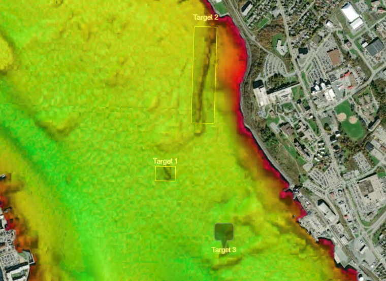
- The minimum and maximum elevation can now be stored at the Project level. This can be set and used for all Visualizations in the Project to ensure consistent color maps across all data products.
Fixes:
- Double-clicking an Object on the globe will open the Projects window for that Object instead of displaying an error message.
- Changes in the new Safari 18 release from Apple resulted in a blank screen when visiting Absolute Ocean. This has been fixed.
October 12, 2024
Enhancements:
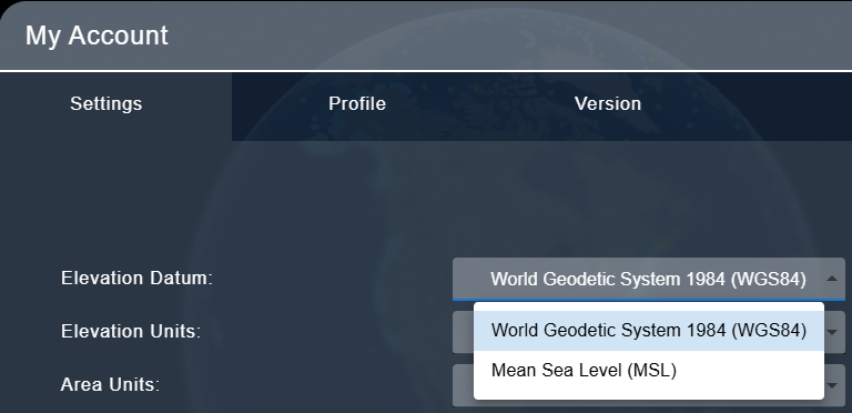
- Choose your own datum! A new setting is available in user profile settings to select whether elevation/depth values are displayed in World Geodetic System 1984 (WGS84) or Mean Sea Level (MSL). This setting affects the display of Profile Lines, elevation values shown for the user cursor when 3D terrain is enabled, and color map legends.
Fixes:
- When uploading a ZIP file with the "Unzip Archives" option enabled, the contents of the ZIP would be placed at the root folder of the Project, regardless of which sub-folder the user is in. ZIP files now properly extract to the current folder.
- Under certain conditions, the Measure tool was not displaying correctly on the screen when in use. This has been resolved.
- Several issues with the Objects have been resolved:
- When selecting an Object from the map, the Object properties are opened instead of the list of Objects.
- Objects now remain visible when the Projects window is closed. Clicking the "x selected" button now closes visible Objects.
- Objects now visualize without refreshing the browser.
- Individual Objects will now remain individually visible instead of grouping themselves at certain zoom levels.
September 18, 2024
Major enhancements:
- We are pleased to announce the availability of Absolute Ocean for self-hosted environments. This new product provides a turn-key deployment of our Absolute Ocean platform for customers with stringent security or data sovereignty requirements. This solution provides a comprehensive suite of new administrative tools to simplify deployment and maintenance by in-house IT departments.
- We now explicitly include the vertical datum of all depths/heights displayed in Absolute Ocean, including the cursor position and profile tools. By default we display depths/heights relative to the global standard WGS 84 ellipsoid, which allows a common reference frame no matter where you are in the world. We now support displaying as Mean Sea Level depths/heights based on the Earth Gravity Model 2008 (EGM2008). To access this feature, in Absolute Ocean press Shift+D to switch the displayed units.


Enhancements to existing functionality:
- The command-line based Upload tool for Absolute Ocean now produces a summary report at the end of the process to succinctly describe any failures which occurred during upload. This negates the need to review the entire log to locate any problems encountered. For access to the upload/ download tool, please contact customer success.
Fixes:
- Several file upload failure cases have been addressed. This includes errors renewing a login over a long duration upload, as well as error cases relating to hosting in environments other than the commercial Google Cloud platform.
June 24, 2024
Enhancements to existing functionality:
- Absolute Ocean has been updated to better align our handling of GeoTIFF Coordinate Reference System (CRS) definitions with the official GeoTIFF standard. This means more GeoTIFF files with non-standard but valid CRS definitions can now be visualized.
- Customers deploying the self-hosted version of Absolute Ocean can now customize the automated email notifications issued by the system.
Fixes:
- XYZ files using a comma as the field delimiter are once again able to be visualized.
May 28, 2024
Major enhancements:
- We are thrilled to announce that we support US tidal datums, you can now upload data in US tidal datum and AO will convert the visualization into WGS84. Note that your file remains unchanged, the transformation is only to ensure that all grids, elevation values and profile lines in AO are displayed relative to WGS84.
Enhancements to existing functionality:
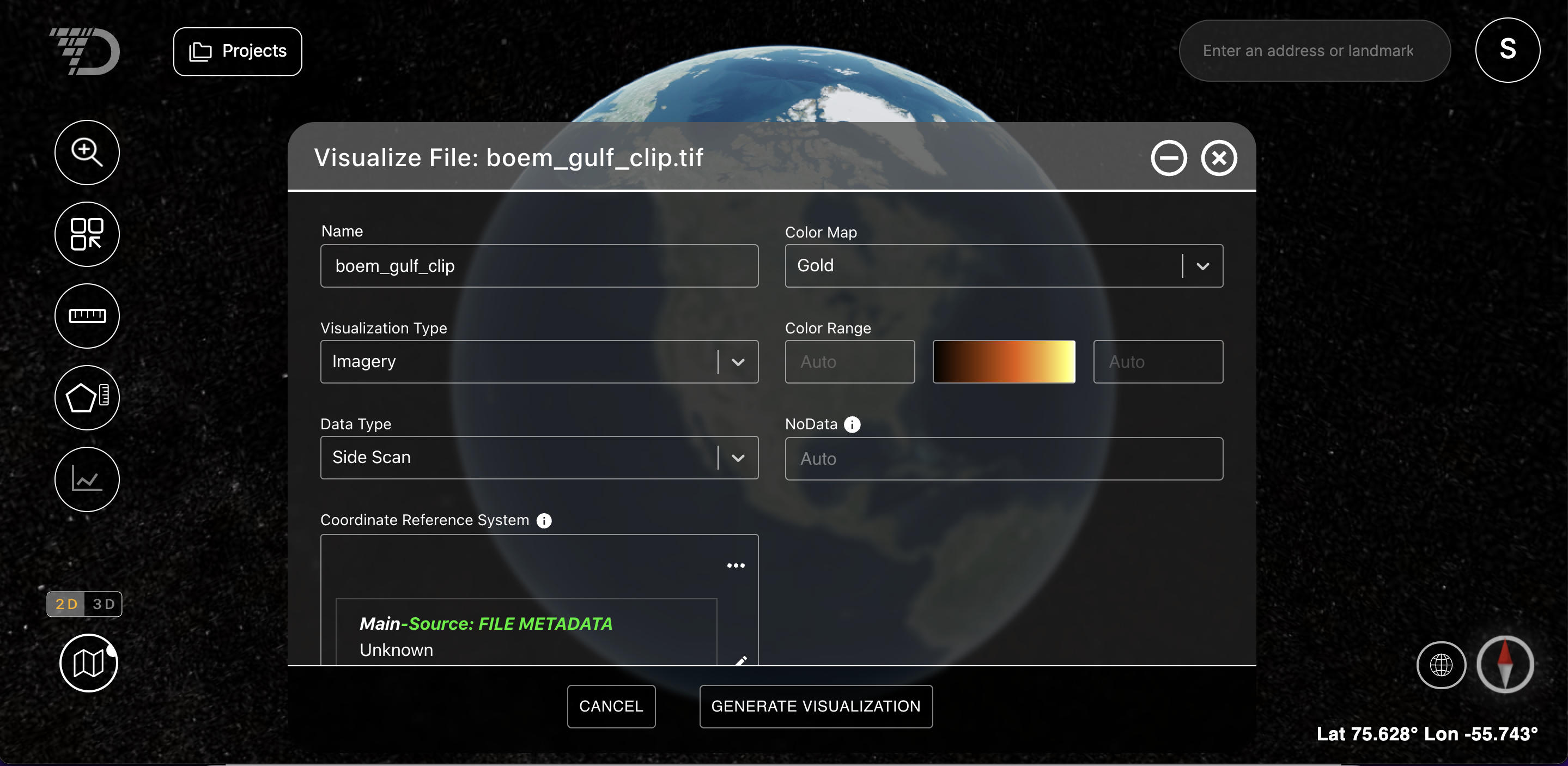
- NoData is a term for null values in raster datasets that indicate that no measurements have been collected for a pixel. In AO, the NoData value is automatically read from the file header information and set to ensure data accuracy. Please only change the value of the input field on the File Visualization screen if you are confident you need to change this value and know what the accurate NoData value in your data set is.
April 17, 2024
Major enhancements:
- AO supports Single sign-on as well as two-factor authentication. If you are using Microsoft as your identity provider, you can start using that today (see below), Google has been supported for a while. If you have other identity providers, please contact AO support.
Enhancements to existing functionality:
- You can now delete a large amount of data from AO in case you accidentally upload large folders/ files.
March 21, 2024
Maintenance enhancements:
- AO now automatically refreshes the Visualization tab so you can see visualization progress without pressing the refresh button. Note that you can still use the refresh button to instantly update status.
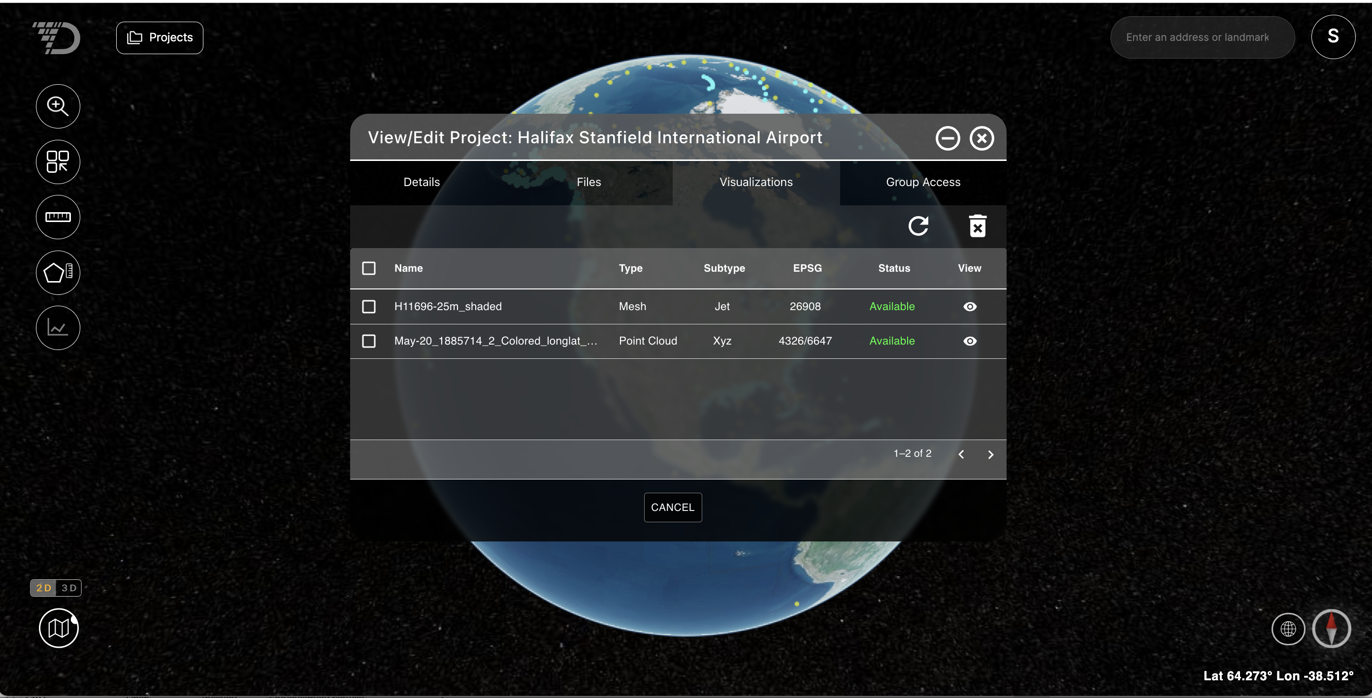
- We now display NOAA graphical charts above your grids, press '9' to visualize the NOAA nautical charts and continue to press '9' to make it more transparent or make it invisible. Please see General FAQ for details on Hot Keys in general.
Fixes:
- We no longer allow a user to attempt to visualize a 3-banded GeoTIF file as bathymetry, 3-banded files can only be visualized as images, please see Supported file types and format requirements for details.
February 12, 2024
Enhancements:
Vertical datum support
We are excited to share that AO now supports vertical datum transformations for visualizations, meaning you no longer have to import your data in WGS 84 vertical datum in order for the data to display accurately compared to the rest of the AO terrain.
When you visualize a bathymetric file, AO will attempt to read the vertical datum from the file header and will default to it if available. Note that this is rarely available. If AO cannot read it from the file, project-level defaults from the Project Details tab are selected (see Screen 2 below). If vertical datum is not available in the file and also not set at a project level, you will need to enter this before visualizing a bathymetric file. Note that the Visualize File screen will show the source of the CRS selections (see Screen 1 below).
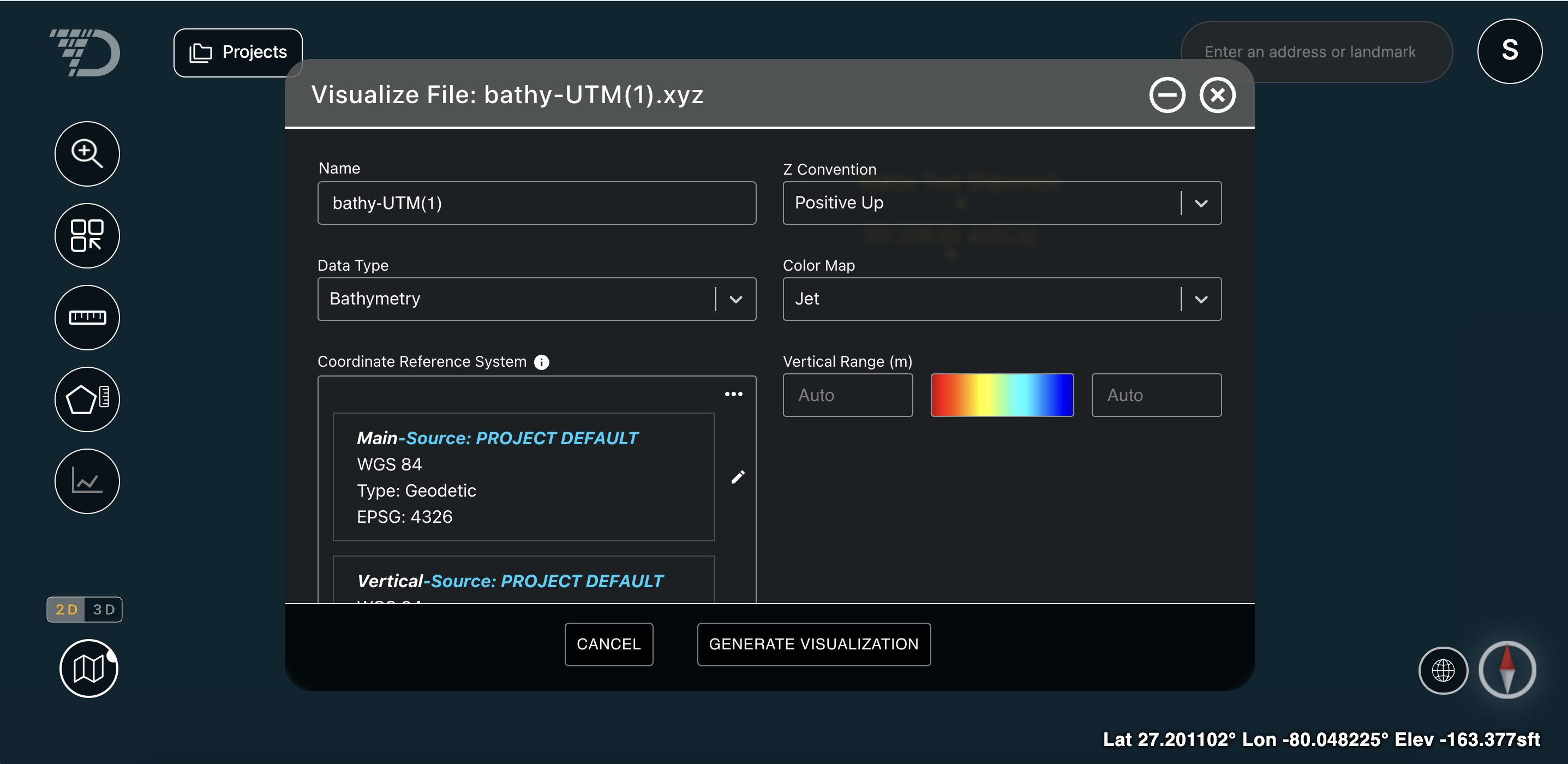
Screen 1: Visualize File window
Please ask your surveyor to provide both vertical and horizontal datum for the data collected and set this as a default at a project level (see Screen 2 below).
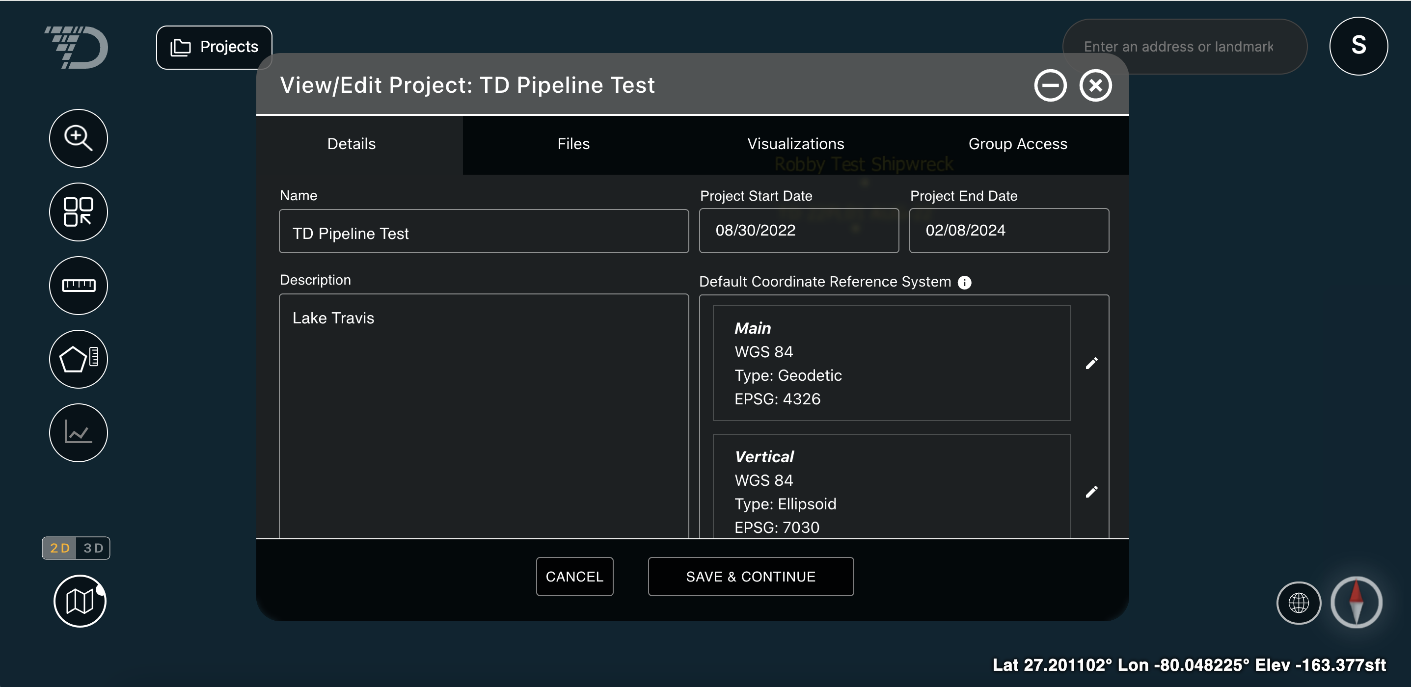
Screen 2: Project Detail window
Note that bathymetric files (both grids and point clouds) require both vertical and horizontal datum, images are draped over terrain and vector files are currently displayed at z = 0 and therefore only need horizontal datum.
For more information on vertical and horizontal datum, please see this help center document: Vertical and Horizontal Datum
Large file support
Architectural changes have made visualization of very large files possible and also faster. We support very large, high-resolution files and have tested pipeline data files of 1.5 TB of raw, uncompressed data, representing 384B pixels, or an area 7.4 times Manhattan.
For earlier releases, see AO Release Notes 2023.