
What is vertical and horizontal datum? NOAA’s definitions
NOAA’s vertical datum definition:
A vertical datum is a surface of zero elevation to which heights of various points are referenced. Traditionally, vertical datums have used classical survey methods to measure height differences (i.e. geodetic leveling) to best fit the surface of the earth. Source: https://www.ngs.noaa.gov/datums/vertical/
Meaning the depth of the sea bottom will have different values depending on what datum you are measuring the depth relative to.
Here is a visual for you
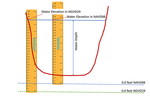
Source: ttps://www.sfwmd.gov/science-data/new-measuring-standard-will-improve-accuracy-water-level-data
You can compare this to measuring temperature: you can measure temperature in Fahrenheit or Celsius, the values will be different but you can calculate one based on the other.
NOAA’s definition of horizontal datum:
The horizontal datum is a collection of specific points on the Earth that have been identified according to their precise northerly or southerly location (latitude) and easterly or westerly location (longitude).
The Horizontal datum is used to accurately position a visualized grid accurately relative to the rest of the world within Absolute Ocean (AO).
To learn more about datums from NOAA: https://oceanservice.noaa.gov/facts/datum.html
How does this impact geospatial software
Imagine you're planning to construct a complex and intricate 3D puzzle on a table. The puzzle pieces represent various geographic data points or features. Now, think of the table as the Earth's surface. In this analogy, the vertical datum is like the height of each puzzle piece above the table, while the horizontal datum is akin to the position of each puzzle piece on the table.
The vertical datum ensures that the puzzle pieces stack up properly in relation to each other, preventing inaccuracies in the puzzle's height and big cliffs between puzzle pieces. Without a consistent vertical reference, pieces might be misplaced vertically, leading to a distorted and unreliable representation of the puzzle.
On the other hand, the horizontal datum ensures that the puzzle pieces are correctly positioned in terms of their lateral relationships on the table. Without a consistent horizontal reference, pieces might be scattered randomly across the table, causing misalignment, gaps, and overlaps and confusion in understanding the puzzle's overall picture.
In the same way, vertical and horizontal datums in geography provide standardized references for measuring elevations and positions on the Earth's surface. They establish a common framework, allowing accurate and meaningful comparisons of spatial data, whether it's understanding the height of mountains or the precise location of cities on a map.
How this is used in AO
One of AO’s strengths as a geospatial solution is its uniqueness in visualizing your data within the context of the rest of the world. For a visualization to be placed at the correct location, all data within AO need to measure depths against the same context or datum and know what horizontal context is used for the survey data (comparing apples to other apples vs to oranges).
From a display perspective, we use WGS84 as the default datum in AO since this is the global standard datum against which all other datums are referenced. This is the only datum which can practically be used to display any dataset, anywhere on the globe in 3D.
AO uses the file information together with the provided vertical datum to position your visualized grids at the right elevation compared to the global base terrain and it uses the file information coupled with the horizontal datum to position the grid at the right location (horizontally).
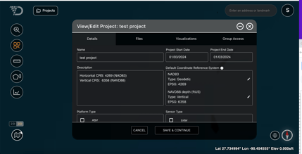
We strongly recommend adding both vertical and horizontal datum information in the AO Project Description field as well as setting these as defaults at a Project level on the View/ Edit Project screen (see image below).
Your files are not changed
AO does not modify your original file loaded to the File tab of the Project. We do transformations as required to the visualize the file in context with all other data on an accurate 3D model of the Earth. These transformations have significant variation in accuracy depending on the source and target datums, as well as position on the Earth. We strive to provide the highest accuracy at all times but are subject to these factors when dealing with global transformations.
Where does AO find the horizontal and vertical datum?
Horizontal datum
Depending on the file type, the horizontal datum is often included in the header of the file. AO will attempt to read this from the file header and, if available, AO will provide the header’s Coordinate Reference System (CRS) as default when you visualize a file.
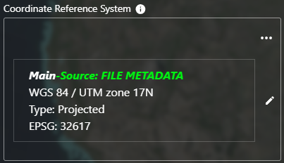
If no horizontal datum is found in the file header, AO will use the default set at the Project level, if this was previously defined.
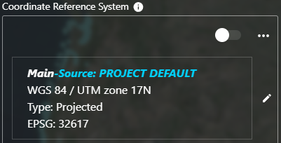
If no CRS is found in the file header, and no CRS is defined at the Project level, AO will warn you that a CRS has not been determined.
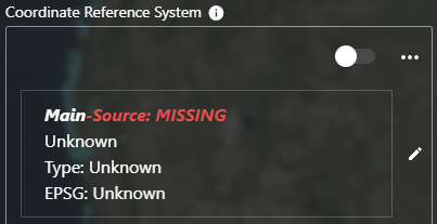
For all 3 cases, the CRS can be overridden by clicking the pencil icon ( ) on the right-hand side of the control.
Vertical datum
A vertical datum is not commonly found in the file header. It is often described in documentation that accompanies the survey files; alternatively, the surveyor that collected the data will be able to provide you with the vertical datum used for the survey. If AO does not find a vertical datum in the header, it requires you to fill in a vertical datum to visualize a file. AO currently supports transforming both WGS84 and MSL datasets for display.
If you do not have the vertical datum, you can usually select MSL as a common standard. Click the pencil icon () on the right-hand side of the control and search "MSL". There are two standard definitions of MSL available: "MSL Height" for Z positive-up datasets and "MSL Depth" for Z positive-down datasets. Choose the appropriate definition and click Select to set the vertical datum.
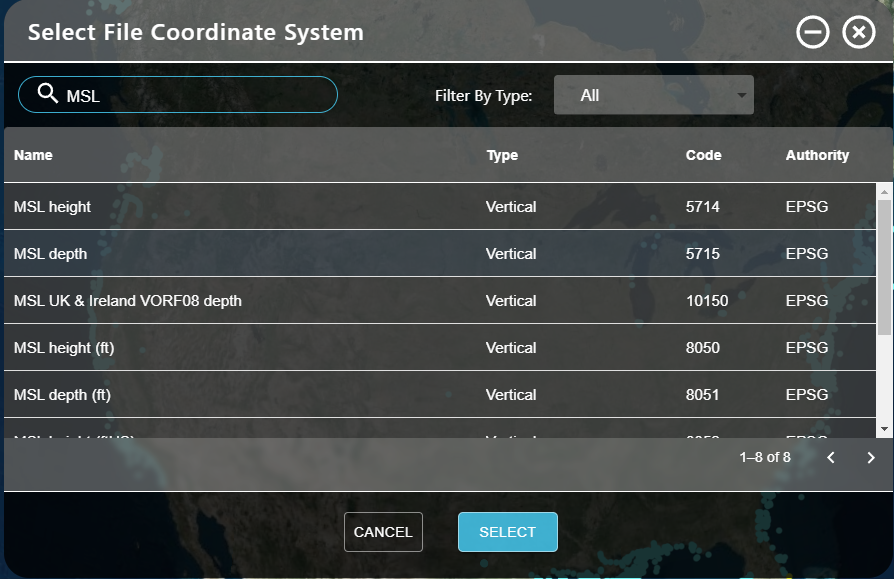
If the default vertical datum is set at a Project level, AO will use this default.
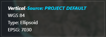
As with the Horizontal CRS selection, click the pencil icon () on the right-hand side of the control to set or override any default settings for vertical CRS.
Be aware that choosing the wrong vertical datum can result in your bathymetric grid appearing above or below where it should be compared to the surrounding terrain in Absolute Ocean, resulting in a cliff between AO’s global terrain and your grid. The elevation values displayed may differ from the original file, as they may have been transformed to the WGS84 datum for display.
Unknown Vertical CRS
If the vertical CRS is unknown and MSL is not the appropriate selection, you can specify a vertical shift offset manually instead of selecting a pre-defined vertical CRS model. Toggle the slider switch at the top of the Coordinate Reference System control to enable manual input of a vertical offset.
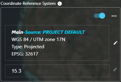
The vertical CRS input will change to an input field, enter a vertical offset to be applied to the entire dataset to line it up with the global terrain in AO. This approach may take some trial and error to produce an appropriate value.