
My Account shows your account details and holds the display settings that change how AO shows heights, distances, areas and positions. This article covers its three tabs: Settings, Profile and Version.
Open My Account
Click your initial in the top right corner and choose My Account. Every role can open it.
Settings
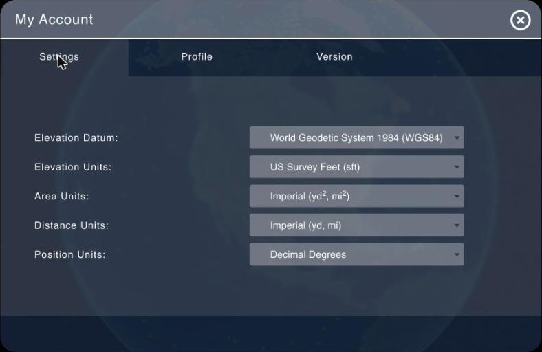
Choose an option from each list. The change applies straight away, so there's no Save button.
| Setting | Options | What it changes |
|---|---|---|
| Elevation Datum | World Geodetic System 1984 (WGS84) (default), EGM2008 Geoid (Mean Sea Level) | What heights are measured from in the cursor readout (Elev (WGS84) or Elev (MSL)), the Measure 3D Profile chart and a visualization's depth legend |
| Elevation Units | US Survey Feet (sft), Metric (m) (default) | Heights in the cursor readout, profile chart and depth legend, and the elevation values in project details and when you visualize a file |
| Area Units | Imperial (yd², mi²), US Survey Feet (sft²), Metric (m², km²) (default), Nautical Miles (nmi²) | Measure Area |
| Distance Units | Imperial (yd, mi), US Survey Feet (sft), Metric (m, km) (default), Nautical Miles (nmi) | Measure Distance, and the distance in Measure 3D Profile |
| Position Units | Decimal Degrees (default), Degrees/Minutes, Degrees/Minutes/Seconds | The cursor readout, Copy Lat/Lon to Clipboard, and latitude and longitude boxes, such as an object's position |
Imperial and Metric switch to the larger unit for long distances and large areas, such as km above 1 km.
Elevation Datum changes only the heights AO shows you. It doesn't move data on the map or change your files. To set the vertical datum of a file when you visualize it, see Vertical and Horizontal Datum.
For the tools these settings affect, see Map tools.
Where settings are saved
AO saves your settings to your AO account, not to the browser. They follow you to any browser or computer you sign in on, and they're the same in every organization you belong to. AO loads them each time you open it.
If AO can't save a change, it still applies it for now and shows Your settings have been applied but cannot be saved at this time. Try again later; if it keeps happening, contact support@terradepth.com.
Profile
The Profile tab shows your account:
| Field | What it shows |
|---|---|
| The email address you sign in with | |
| Name and Nickname | Your full name and nickname |
| Role | Your role in the organization you're working in. See User Management. |
| Organizations | The organization you're working in, with "(+N more)" if you belong to others |
| Groups | Your groups in that organization. Only Professionals and Admins see their groups here. |
You can't edit these fields here. To change your name, nickname or email, ask your organization's Admin.
Reset Password opens a page where you enter a new password, confirm it and choose Reset. The password needs at least 8 characters, including an uppercase letter, a lowercase letter and a number. AO hides Reset Password while your computer has no network connection. For more on passwords, see Signing in and passwords.
Version
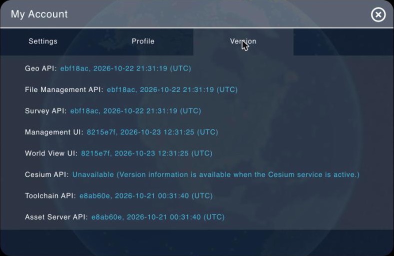
The Version tab lists each part of AO, its user interfaces and its services, with a short version code and the date and time (UTC) it was built. A part that isn't responding shows Unknown or Unavailable instead.
To find which release your AO runs, look up the Geo API row's version code under Which release does my AO run? in AO Release Notes 2026. Terradepth support may ask for these details when you report a problem: take a screenshot of the tab and send it to support@terradepth.com.
If you belong to more than one organization
Choose the organization you're working in at the top of the menu under your initial. Your role and groups on Profile are for that organization; your display settings stay the same. See User Management.
Availability: multiple organization membership is turned on per organization. To use it, contact support@terradepth.com.
Related: Signing in and passwords · Vertical and Horizontal Datum · Map tools